
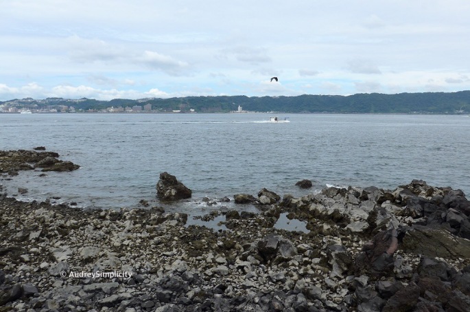
Time to leave Kagoshima, to continue our road trip. We keyed in our destination, Kagoshima Ferry Terminal, on our GPS and drove on to the ferry to Sakurajima. In fact, we did not know how we got ourselves on to the ferry. We just kept driving and when people waving to us to enter, we just kept going till we got on the ferry. We have no idea if the ferry will bring us to Sakurajima till we eventually reached there. That was our first time driving on a ferry and also our first time to step on an active volcano island.

After parking our rental car, we went up to the upper deck to take some pictures. Before we could relax, we were almost arriving at Sakurajima Ferry Terminal. We ran down to our car to get ready to drive off the ferry. The ferry ride was just fifteen minutes.

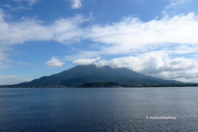
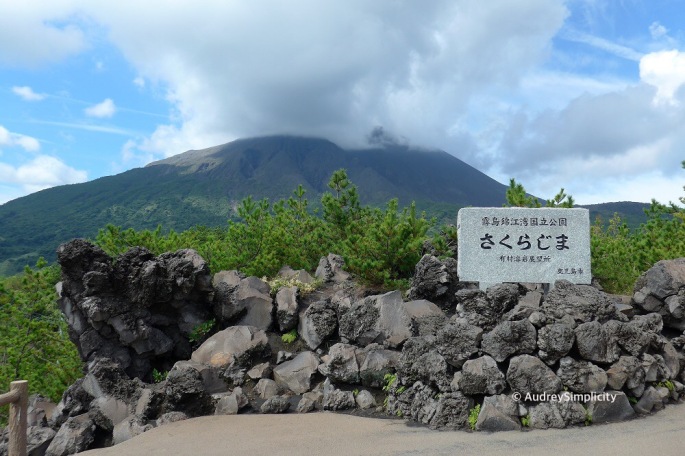
Sakurajima 桜島 which literally means “Cherry blossom Island”, is one of Japan’s most active volcanoes and is also the symbol of Kagoshima. Sakurajima has an elevation of 1,117 metres and a circumference of about 50 kilometres. It was an island, located in the middle of Kagoshima Bay, before a powerful eruption in 1914, the massive lava flow of the eruption connected it with the Osumi Peninsula in the east.

Our first stop was to the Visitor Centre to collect brochures and map that we may get our orientation of Sakurajima. The Visitor Centre is about ten minutes walk from the Sakurajima Ferry Terminal.
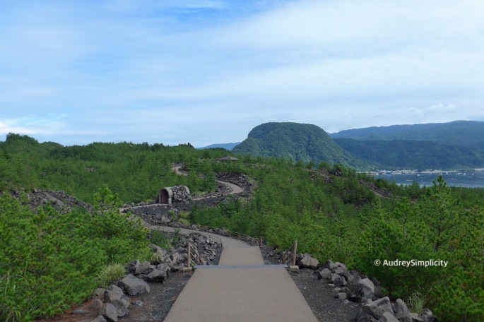
We parked our car at the Visitor Centre and explored the Lava Trail and Nagisa Park Foot Bath.


Arriving at the Nagisa Park Foot Bath, we saw families dipping their feet into the foot bath, having a good time, relaxing and chatting away, enjoying the beautiful view.

Feeling excited, I took off my shoes, removed my socks, rolled up my jeans and dipped my feet into the foot bath. Lo and behold, the water is piping hot, I felt my skin was about to be cooked. I quickly took a picture of my legs dipping in the bath and got my foot out of the water. My legs were red. Guess I have very thin skin.

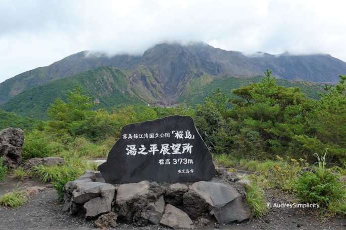
We walked back to our car to drive to Yunohira Observatory, the highest observation point accessible to the public on Sakurajima which is at 373 metres above sea level. It is also closest to the Sakurajima’s crater, about 2.5 kilometres away.

Mount Sakurajima with a circumference of 52 kilometres, seen as a single mountain, actually consists of three parts, Kitadake (North Peak) 1,117 metres, Nakadake (Middle Peak) 1,060 metres and Minamidake (South Peak) 1,040 metres above sea level. With Mount Aso, Mount Asama and Mount Mihara, Mount Sakurajima is numbered among the four biggest volcanoes and is said to be the largest in Japan in its volcanic energy.
Sakurajima has continued its repeated eruptions in Bunmei Era (1476), Anei Era (1779), Taisho Era (1914), and Showa Era (1946). The drastic eruption in 1914 resulted in torrents of lava spread to a width of 400 metres, consequently filling up channel Seto 72 metres deep, connecting the land with the Osumi peninsula in one continuous stretch of land, creating a key traffic route to Osumi district and to Miyazaki prefecture.

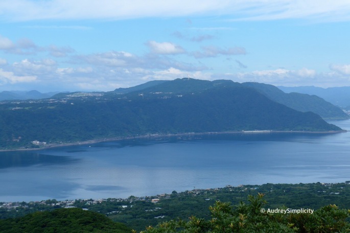
From Yunohira Observatory, we have a beautiful view of Kinkowan or Kinko-Bay, made by the volcano. About 30,000 years ago, a large amount of magma was released after a huge eruption occurred on the inner side of Kinkowan. This caused the land to be become empty and dented – “Aira-Caldera”. The 200 metres deep Kinkowan was created after the seawater entered in.


I found it interesting that the residents of Kagoshima are not affected by the eruptions and there are so many tourists visiting the Sakurajima. Perhaps they are used to the eruptions as I learnt that Sakurajima erupts over 800 times each year.
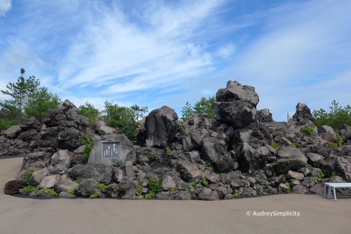
Leaving Yunohira Observatory, we took route 224 to Arimura Lava Observatory, where we saw Taisho Lava and Showa Lava.


While we were at Arimura Lava Observatory, we were hit by volcanic ash. Initially, I didn’t know I was hit by volcanic ash till my friend alerted me, asking me to look up at the volcano that was sprouting out tiny black particles. Glad I was wearing sunglasses that gave some level of protection to my eyes. My face, neck, hands and backpack were covered with sprinkles of volcanic ash. It was the first time I was hit by volcanic ash. What an experience.

As it was past lunchtime, we grabbed a quick bite and continued to our next stop, Umagase. Stay tuned for my next post.
This trip was made in October 2017.
The Lowdown
How to get to Sakurajima – Kagoshima and Sakurajima are connected around the clock by frequent ferries, one-way ride takes 15 minutes at 160 yen for adults and 80 yen for children. If you are driving, the fare is at 270 yen for a car which includes the one driver. The Kagoshima ferry terminal is about ten minutes walk from JR Kagoshima Station.
How to get around Sakurajima – The easiest way to travel around Sakurajima is by rental car, which can be taken onto the ferry. You could also travel around Sakurajima by public transportation. There is a loop bus for tourists, the Sakurajima Island View Bus, that operates hourly from the ferry terminal to the Yunohira observation point and back.
For more information, got to www.sakurajima-kinkowan-geo.jp/en/.
Thank you for stopping by, Happy Living for Experiences!
Stay in touch by connecting with me on Facebook and Instagram.

Wow what a beautiful place.
LikeLiked by 1 person
Great post – looks like an amazing place. Kind of reminds me of one of my favorite places – Hawaii.
LikeLiked by 1 person
Thank you 😊 We had one amazing time there. I have never been to Hawaii. A place I would love to visit.
LikeLiked by 1 person
Add it to your list! I recommend Kauai.
LikeLiked by 1 person
Wonderful place, beautiful photos enjoyed reading.
LikeLiked by 1 person
Thank you 😊
LikeLike
Oh this so reminds us of our drive too! And fortunately, we were not hit with the ash even though the Caldera was constantly smoking!
LikeLiked by 1 person